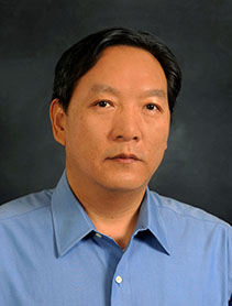
Dr. Zhiyong Hu
- Position: Professor
- Department: Earth and Environmental Sciences
- Office Location: Building 13, Room 320
- zhu@uwf.edu
- Campus: 850.474.3494
Biography
Professor Dr. Zhiyong Hu specializes in geographic information systems (GIS), remote sensing, spatial analysis and modeling in urban areas, environmental studies and environmental health. He joined the Department of Earth and Environmental Studies after graduating in 2004 from the University of Georgia. Hu’s research has used GIS and remote sensing to study urban sprawl, potential cybersecurity attacks on a college campus, and the relationship between an area’s air quality and the risk of heart disease, stroke, asthma and other illnesses. His work has been published in Computers & Geosciences, IEEE Proceedings of the 23rd International Conference on Geoinformatics, Geospatial Analysis of Environmental Health, International Journal of Health Geographics, Environmental Health, Computers, Environment and Urban Systems, GIScience & Remote Sensing, and Journal of Applied Remote Sensing among others.
Hu won UWF Excellence in Undergraduate Teaching and Advising awards in 2009 and 2014. He has bachelor and master degrees in geology from Northeastern University in China. He teaches Intro GIS, GIS Applications, GIS Programming, Remote Sensing, Applications in Remote Sensing, Special Topics in GIS, Advanced GIS Topics, Geostatistics, and other courses. Hu is a frequent reviewer of articles submitted for publication in Environmental Science & Technology, Journal of Geographic Systems, Landscape and Urban Planning and other scholarly journals.
Degrees & Institutions
Ph.D. Geology, University of Georgia
M.S. Geology, Northeastern University, China
B.S. Geology, Northeastern University, China
Research
Geographic Information Systems (GIS), remote sensing, spatial analysis and their application in earth and environmental sciences and human-environmental interactions. Specific research experience and interest are: spatial statistics, method of land use/cover classification from remote sensing, land use/cover change (including urban growth) detection and modeling, air pollution and public health, spatial pattern and process analysis.
Classes Taught
- Geographic Information Systems (GIS)
- Applications of GIS
- Special Topics of GIS
- Advanced Topics of GIS
- GIS Programming
- Remote Sensing
- Applications of Remote Sensing
Publications
Hu's work has been published in Computers & Geosciences, IEEE Proceedings of the 23rd International Conference on Geoinformatics, Geospatial Analysis of Environmental Health, International Journal of Health Geographics, Environmental Health, Computers, Environment and Urban Systems, GIScience & Remote Sensing, and Journal of Applied Remote Sensing among others.
Keywords: Geographic Information Science or Geographic Information Systems (GIS), remote sensing, spatial analysis, environmental health, urban growth, air pollution, environmental modeling and analysis


