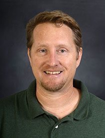
Dr. John Derek Morgan
- Position: Associate Professor
- Department: Earth and Environmental Sciences
- Office Location: Building 13, Room 315
- jmorgan3@uwf.edu
- Campus: 850.474.2224
- Personal UWF Website
Biography
John D. Morgan is the primary faculty for the new online GIS Master's program offered by the Department of Earth and Environmental Studies. Morgan, who is an Associate Professor, graduated from Florida State University with a Ph.D. in Geography.
Morgan has over fifteen years of professional information technology experience (including GIS). Before he joined UWF, Morgan spent four years as an Applied Research Software Designer at the National Environmental Modeling and Analysis Center at the University of North Carolina at Asheville.
Degrees & Institutions
PhD Geography from Florida State University; Master of Science in Management and Bachelors of Arts in Economics from University of Central Florida
Research
Dr. John D. Morgan is an urban environmental geographer who uses state-of-the-art geo-spatial methodologies to study how humans navigate changing environments in public space. This work involves three interrelated strains of work that focus on (1) developing spatial tools for safer communities, (2) participatory mapping of ecosystem services that considers local cultural attachment to place, and (3) innovative spatial modeling that informs land use planning, risk assessment and decision making.
Current Courses
- GIS Management
- Communicating GIS
Classes Taught
- Cartographic Skills
- GIS Management
- Communicating GIS
- GIS Programming
- Advanced Topics in GIS
- Applications in GIS
Publications
Recent Publications
Douthat, T. H., Morgan, J. D., Alibasic, H. & Grant, A. (2019). Passive Building Characteristics, and Summertime Residential Energy Use: A Spatial Analysis of Energy Efficiency in Gainesville, FL Building and Environment
Morgan, J. D. (2019). Review of Free the Beaches: The Story of Ned Coll and the Battle for America's Most Exclusive Shoreline by Andrew W. Kahrl published the Journal of Historical Geography. DOI: 10.1016/j.jhg.2019.04.005
Evans, J., Evans, S. Z., Morgan, J. D., Snyder, J.A. & Abderhalden, F.P. (2018). Evaluating the Quality of Mid-Sized City Parks: A Replication and Extension of the Public Space Index. Journal of Urban Design. Taylor & Francis; h-index: 31
Eslinger, R. & Morgan, J. D. (2017). Spatial Cluster Analysis of High-Density Vehicle-Bear Collisions and Bridge Locations. Papers in Applied Geography. Taylor & Francis
Morgan, J. D. (2016). A User-centered Design for the Addition of Interactive Masking Capability within an existing Web GIS. Transactions in GIS. Wiley; Impact Factor: 2.252
Morgan, J. D. & Steinberg, P.E. (2013). Testing the Usability of Time-Geographic Maps for Crime Mapping. In Leitner, M.L. (Eds.), Crime Modeling and Mapping Using Geospatial Technologies. Springer
Recent Presentations
Alibasic, H., Morgan, J. D., Douthat, T. H., & Grant, A. “Urban form and Residential Housing Efficiency: Creating a Parametric and a Causal Model of Building”. Southern Political Science Association (SPSA), New Orleans. 5 January, 2018
Morgan, J. D. Coffey, J. W. & Eddy, B. P. “A Pilot Study in Concept Map-based Knowledge Modeling”. Seven Hills Regional User Group for GIS (SHRUG), Tallahassee. 8 November, 2017
Morgan, J. D., Evans, J., Evans, S. Z., & Snyder, J.A. “Mapping Perceptions of Safety in City Parks”. North American Cartographic Information Society (NACIS). Montreal, Canada
Morgan, J. D. Coffey, J. W. & Eddy, B. P. “Concept mapping Web GIS”. Northwest Florida GIS Users Group Spring 2017 Meeting. Destin, FL
Morgan, J. D. “Mapping Perceptions of Safety in City Parks”. 28th International Cartographic Conference of the International Cartographic Association. July 2017 (accepted abstract, unable to attend to present)


