Equipment for Checkout
The GeoData Center uses expert planning and top tools like GPS and survey gear to collect accurate, high-quality field data.
GPS Units
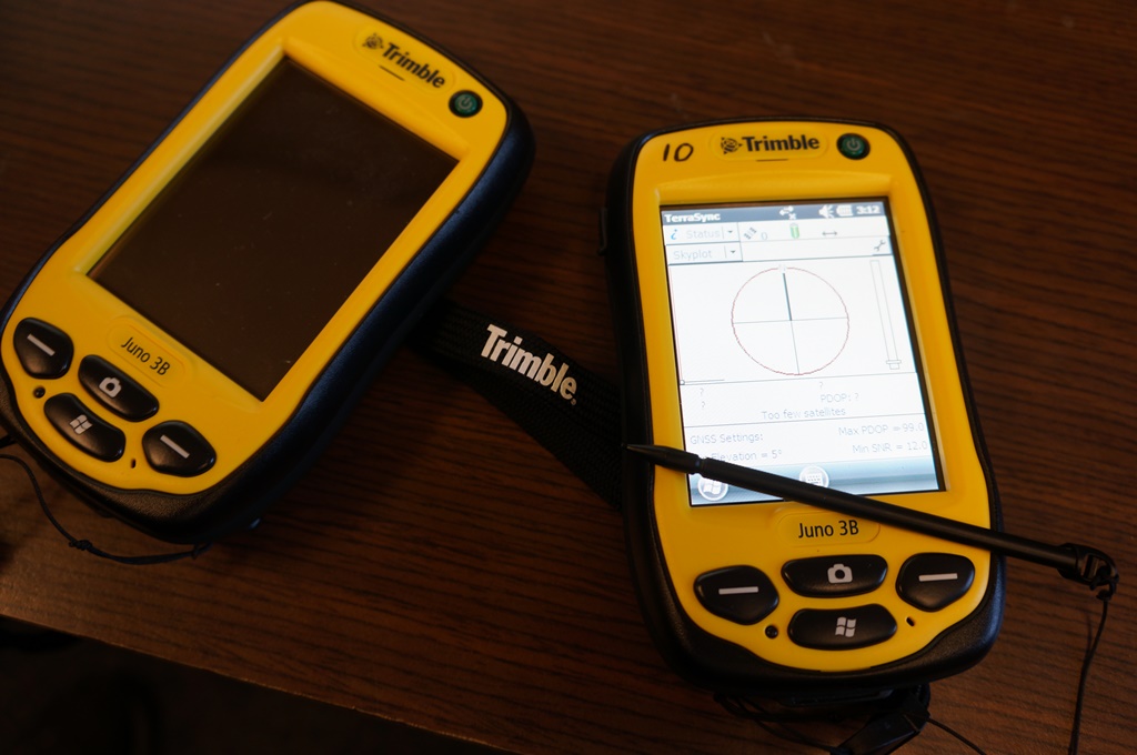
A classroom set (20 units) of Trimble Juno 3B professional GPS units is available for courses or to check out individually for course projects, directed studies or research activities. All units have Trimble TerraSync software installed and many also have ESRI ArcPad, though TerraSync is generally recommended except for users with prior ArcPad experience.
Trimble Pathfinder Office is available in the GIS Laboratory for mission planning, data dictionary creation, data retrieval, and performing post-processing corrections.
Other GPS devices and accessories available:
- Trimble Pro-XR (older backpack style unit) GPS with real time differential
- Thales MobileMapper CE with ArcPad and real-time differential beacon (PDF specs)
- External antenna and pole for Juno or Thales units
- Garmin recreation-grade GPS
- GPS enabled digital still and video cameras
Helpful Resources and Tutorials from Trimble
Surveying Equipment
Additional equipment available through the GeoData Center and the Department of Earth and Environmental Sciences includes:
- Sokkia total station
- Manual Surveyor's Levels
- Metric and US stadia rods
- Surveyor Wheel
GPS Cameras for taking GeoTagged Photos
Cameras for easily creating geotagged still photos or videos can are available to students for check-out from the GeoData Center student for any UWF project. This equipment was acquired through a UWF ITEP grant with the goal of making location based data collection through photography accessible to students and researchers without needing training in geospatial technologies. All units are configured to include geotagging information from your GPS position in each photo's EXIF metadata. Some photo management or backup services may scrub this information. Always check privacy or other settings before deleting the original photo files.
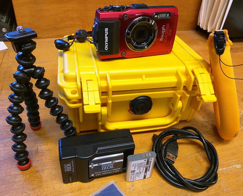
Ruggedized build of this device allows it to be used for shooting still photos or video in wet, dirty or generally unpredictable conditions associated with outdoor fieldwork. Of the three cameras, this features the most accurate GPS and an electronic compass that will also collect the direction photos are taken. With extra care to make sure all ports are tightly sealed, this device is able to be used underwater up to 50 feet.
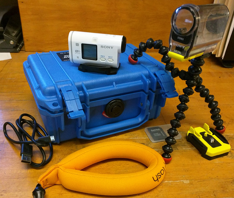
The Sony Action Cam is capable of recording 1080p full-HD videos and wide-angle still photos in 13.5 MP. This unit is very small and has no built in viewfinder screen, but a smartphone with the free Sony app can be used a viewfinder via a wireless connection. Though all of these cameras are capable of capturing video, this device provides the best stabilization by far. The waterproof housing allows use underwater or in wet conditions.
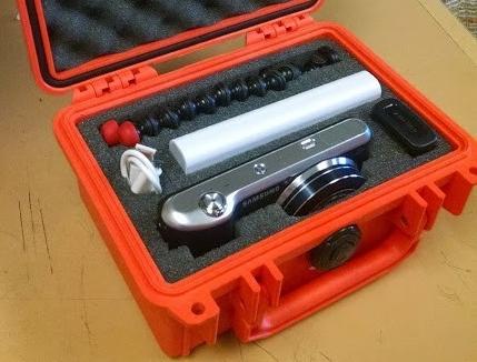
The Samsung camera uses Android operating system commonly found in smartphones and is able to connect to WiFi and install apps from the Google Play store. Many apps for collecting, organizing and publishing geotagged photos are already installed. This camera also features a 21x optical zoom and a large (4.8 in) touch screen. It is not suggested that this camera be used in wet, dirty or otherwise harsh conditions.
Accessories available: Storage media, full size and portable tripods, power banks for extended battery life, various mounts constructed for different environments.


