


Visit Conservation Areas
Recreation in the Conservation Areas
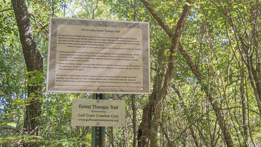
The main campus UWF Conservation Areas are open to the public for recreation, with the most popular activities being hiking, biking, and running. The UWF Beach Reservation is open to the public between sunrise and sunset for activities such as swimming. Additionally, the Baars-Firestone Wildlife Sanctuary recently became a Shinrin-yoku forest therapy trail with the help of Gulf Coast Creation Care.
Rules and Guidelines
By utilizing the UWF Conservation Areas, you agree to following the regulations below. These rules protect the safety of both visitors and the Conservation Areas themselves. It is essential that all visitors abide by these rules to maintain the Areas as a natural resource open to the public.
- Living Lab: Forest Rules (coming soon, very similar to beach rules)
- Living Lab: Beach Rules
Parking and Accessibility
Visitors can enjoy northwest Florida’s natural beauty through a system of mixed use trails, which are accessible from three main locations. The West Campus trail system is most accessible from a gravel parking lot at 11969 Pate St., found on Google Maps as the UWF Bike Trails. Parking at the Pate St. trailhead is free to the public. The Edward Ball Nature Trail is a half-mile boardwalk behind Building 10, easily accessed from the developed portion of campus. It also connects to the West Campus trail system. The nearest parking is found in Parking Lot G, a portion of which is open to any UWF parking permit. The Baars-Firestone Wildlife Preserve, a part of the campus cross country trails, is accessed from Parking Lot DC1, which is near the Argonaut Village and open to any parking permit type.
Please acquire a UWF parking permit prior to using any lot that requires one. Free visitor parking passes are available. Visit the Parking for Visitors page for more information.
Unfortunately, none of our nature trails are currently considered accessible by ADA standards. Please note that the Edward Ball Nature Trail is too narrow for many accessibility devices and that the path to its entrance is extremely uneven. We plan to improve accessibility in the future.
Trail Map
Visit UWF Recreation's Trail Maps page to access the UWF West Campus Trail Map. Some users also like to utilize apps such as AllTrails and Trailforks to navigate our trail system. However, please note that we do not have any affiliation with these applications and have not verified their content.