


Earth and Environmental Sciences
Earth and Environmental Sciences students will find excellent opportunities to explore contemporary environmental issues and participate in scientific research with departmental faculty; whether in excellent facilities or in the current Gulf Coast environmental field laboratories.
A Glance at the Program
- Consists of a multidisciplinary approach that combines natural science and research management
- Students learn to analyze physical and socio-economic environments and to reach decisions concerning environmental use and management
- Offers a core curriculum that is designed to provide students with a solid foundation in the earth and environmental sciences, as well as in the modern methods and techniques used by scientists and environmental professionals
- Techniques include remote sensing, geographic information systems (GIS), spatial statistics, and environmental sampling and surveying
- Classes generally host 25-35 students, while labs consist of 15-20 students.
UWF GeoData Center
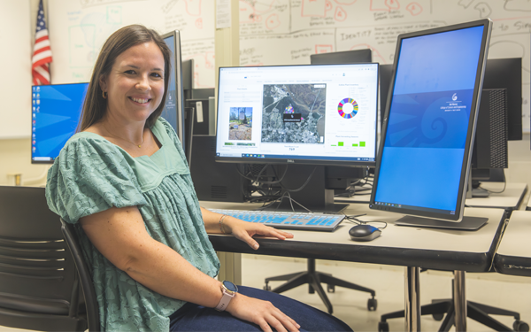
UWF is the only University in Florida designated as an ESRI Development Center (EDC). The EDC program confers special status and benefits upon a select few leading university departments that challenge their students to develop innovative applications based on the ArcGIS platform. Learn more about our Graduate and Undergraduate GIS course offerings as well as GIS research and partnership opportunities through the GeoData Center.
Remembering a Beloved Professor

Professor Droubay started at UWF in 1994 as a part-time adjunct instructor of geography and environmental studies. In the early-to-mid-1990s, Environmental Studies was a popular undergraduate major at UWF. He was the main advisor for the small department, and many say that he held the program together. His position was eventually upgraded to full-time Lecturer. He taught a wide variety of geography and environmental policy courses, and students loved him for the many stories he told and the compassion he held for others. With his connections in the local environmental arena, Professor Droubay secured several research grants. He also led a student group to Cuba in 2003 and was a co-leader on a trip to Honduras in 2001.
Professor Droubay retired from UWF in 2007. Before coming here and after leaving he did so many wonderful things. If you wish to honor his memory, the family has asked that you please consider making a gift in his memory to support scholarships in the Department of Environmental Sciences.
Please keep his family in your thoughts during this time.
Synchronous Online Classes
We started offering synchronous master’s degree classes in the Fall 2019 semester. Synchronous classes allow students to take classes online that are already being taught real-time in a face-to-face format. The synchronous online classes are a professional development opportunity for working professionals. Classes are offered in the late afternoon and early evening so working professionals can attend.
Research Highlights

Coastal Sand Dunes
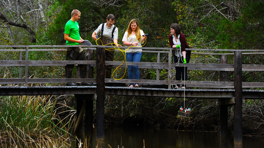
A major reason that people vacation or choose to live in coastal communities is the beauty that coastal sand dune environments provide. Aside from their visual splendor, coastal dunes offer a plethora of ecosystem services, such as natural barriers against storms and waves to protect residential and commercial investments. In this research, Dr, Schmutz and his students conducted surveys with local residents and tourists at Pensacola Beach to assess their knowledge of the ecosystem services that coastal dunes provide as well as their willingness to invest in the protection of these environments. Results indicated that both locals and tourists recognize the environmental and economic importance of coastal dunes, yet the different groups stated contrasting levels in their willingness to support dune management initiatives. Local residents indicated a substantially higher propensity to financially support dune management strategies compared to tourists.
Harris, E., P.P. Schmutz, C. Jackson, M. Anaya, M. Johnson, and G. Chapman. 2020. Beach User Perception on the Economic and Ecological Importance of Sand Dunes at Pensacola Beach, Florida. Southeastern Geographer, 60(4): 309–331. See the picture of the co-authors above.
GIS in Criminal Justice and Law Enforcement
A publication by MS GIS-Administration graduate student Matthew Bradbury, Dr. Morgan from our department, and University of Tampa criminology professor Dr. Timothy Hart was recently accepted for publication (after a round of reviews) in The Geographic Information Science & Technology Body of Knowledge. This is a highly competitive publication and Matthew’s contribution was instrumental in the manuscript being accepted. Matthew happens to work as the GIS Administrator for the City of Redlands (home of ESRI), and his capstone involved developing a crime mapping portal for the City. Congratulations to Matthew and Dr. Morgan on this outstanding achievement.
Department News
.jpeg)
Wetlands Delineations Workshop
UWF Alum, Keith Johnson, led a half day workshop on Wetland Delineations. Keith was part of the UWF team that created Wetland Sciences, Inc over 20 years ago and is now a partner and is running one of the most sought after environmental/wetland consulting companies in the region. Students spent about one hour in the classroom learning background and process information. The remainder of the workshop was held in the field, in the UWF Conservation Forest Living Lab. Spots for the workshop were competitive due to a high interest. Plans to continue this type of professional development opportunities for our students are in the works. If you are interested in leading one, let's chat!
UWF/Broward College Agreement
The University of West Florida has entered into an agreement with Broward College to streamline the transition of Broward College undergraduate students into our Department of Earth and Environmental Sciences master’s program. The 4+1 program will allow qualifying Broward College students to take graduate-level courses at UWF as nondegree-seeking students and apply these courses towards their B.S. degree at Broward College. After graduation from Broward College, the students are automatically admitted to our master’s program through a simplified application procedure. The graduate courses at UWF apply towards their master’s degree here. The agreement reduces the total time required to obtain a master’s degree and helps UWF meet academic and workforce needs.
Ms. Karen Bruening, a former graduate student, was recognized with the 2021 Teacher of the Year Award at Pensacola High School. Way to go, Karen!

Environmental Science undergraduate Monica Woodruff was recognized with a distinguished Cannon Citations Award, given only to students who in some way transform the campus and leave a lasting impact. Monica received the award for helping to transform the campus landscape through her work for the Argos Edible Campus program and the UWF Community Garden program. Congratulations, Monica. Well deserved.


