


NWFL GIS User Group Digital Media Spring 2017
In conjunction with the Northwest Florida GIS User Group, the GIS Online program is proud to host this ongoing online competition showcasing local GIS digital projects.
Professional Submissions
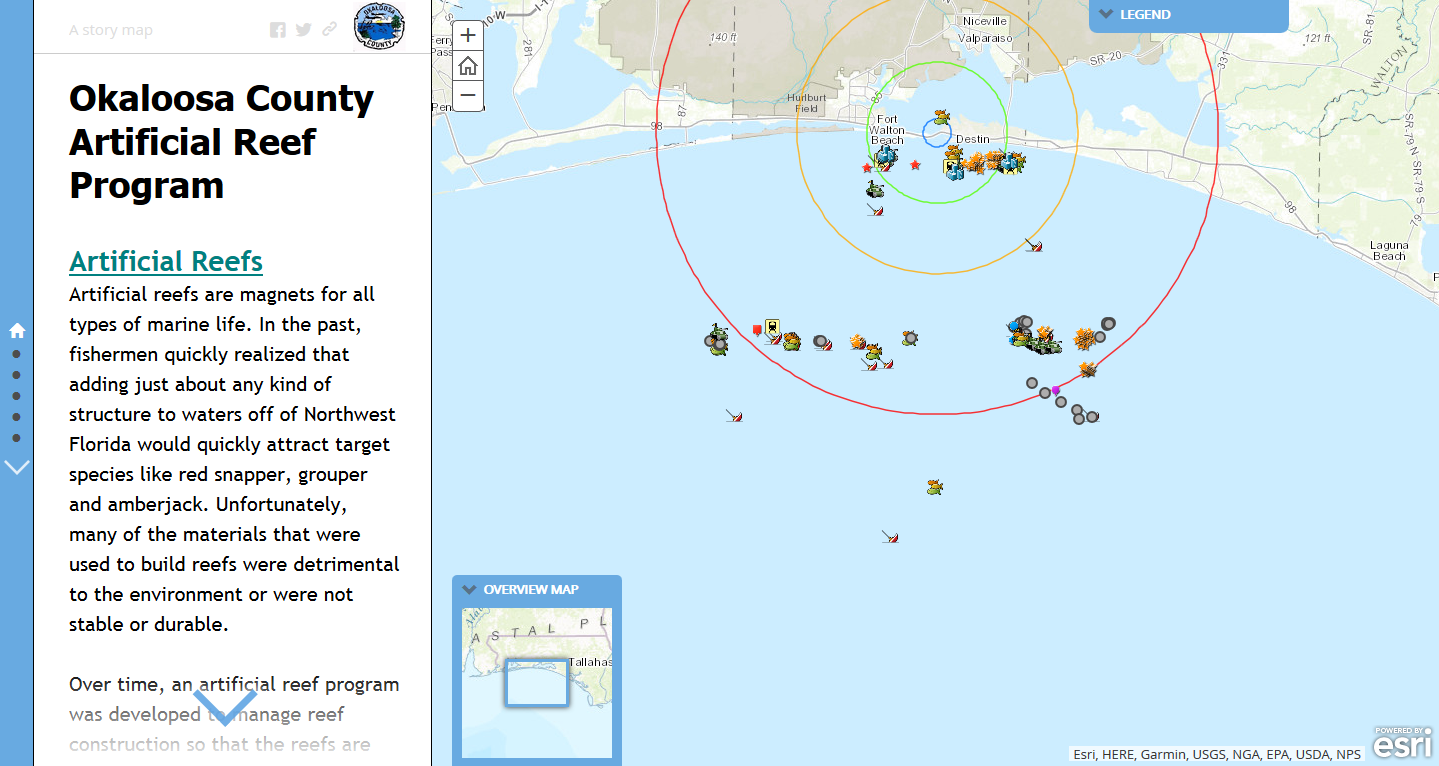
Lance Jones, Okaloosa County GIS - Winner
This Story Map was developed to promote the Okaloosa County Artificial Reef Program. The project map provides anglers and divers alike with critical information about our artificial reefs such as construction materials used, location, depth, and what type fish may be found at Florida reefs. There is also a section covering the invasive Lionfish. The project has spatial data, images, and videos. In addition, it directs people that don't have access to a boat to Okaloosa County diving/fishing charters.
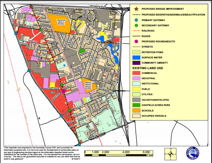
Austin Adkison, Escambia County BCC
This map was created for the Community Redevelopment Agency of Pensacola, Florida. The focus is on improvements in the "Oakfield" district of Escambia County. The person who requested the map wanted to easily be able to differentiate the different types of existing land use as well as the amenities that were being proposed (gateway signs, bridge improvement, roundabouts, bike lanes, and general beautification). They asked for this to be colorized instead of simply in grayscale. This map will be part of a larger plan to promote redevelopment of the Oakfield area.
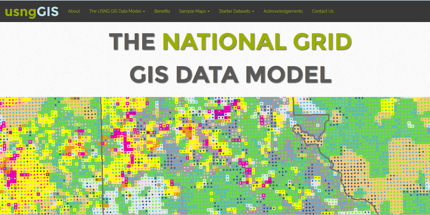
Florida Resources and Environmental Analysis Center (FREAC), Florida State University
Georgianna Strode, Benjamin Thornton, Thomas Tricarico, Beverly Renard, Brittany Gress, Nathan Johnson, William Strode, Dean Jue, Marjorie Jerez, Tyler McAlear, Evan Rau, Sean Shortes
Using the U.S. National Grid as a GIS Spatial Data Model. The United States National Grid (USNG) is a national standard for emergency management. Adopted by FEMA and other agencies, the USNG can pinpoint any area on earth at flexible scales using a simple alphanumeric label. This accurate, flexible grid can now be used for GIS -- mitigating many of the known problems of choropleth mapping, such as polygons with arbitrary and irregular sizes and shapes. Starter datasets for Florida include 1-km population data, land cover, and land use. Everything you need to be up-and-running with the USNG in under an hour!
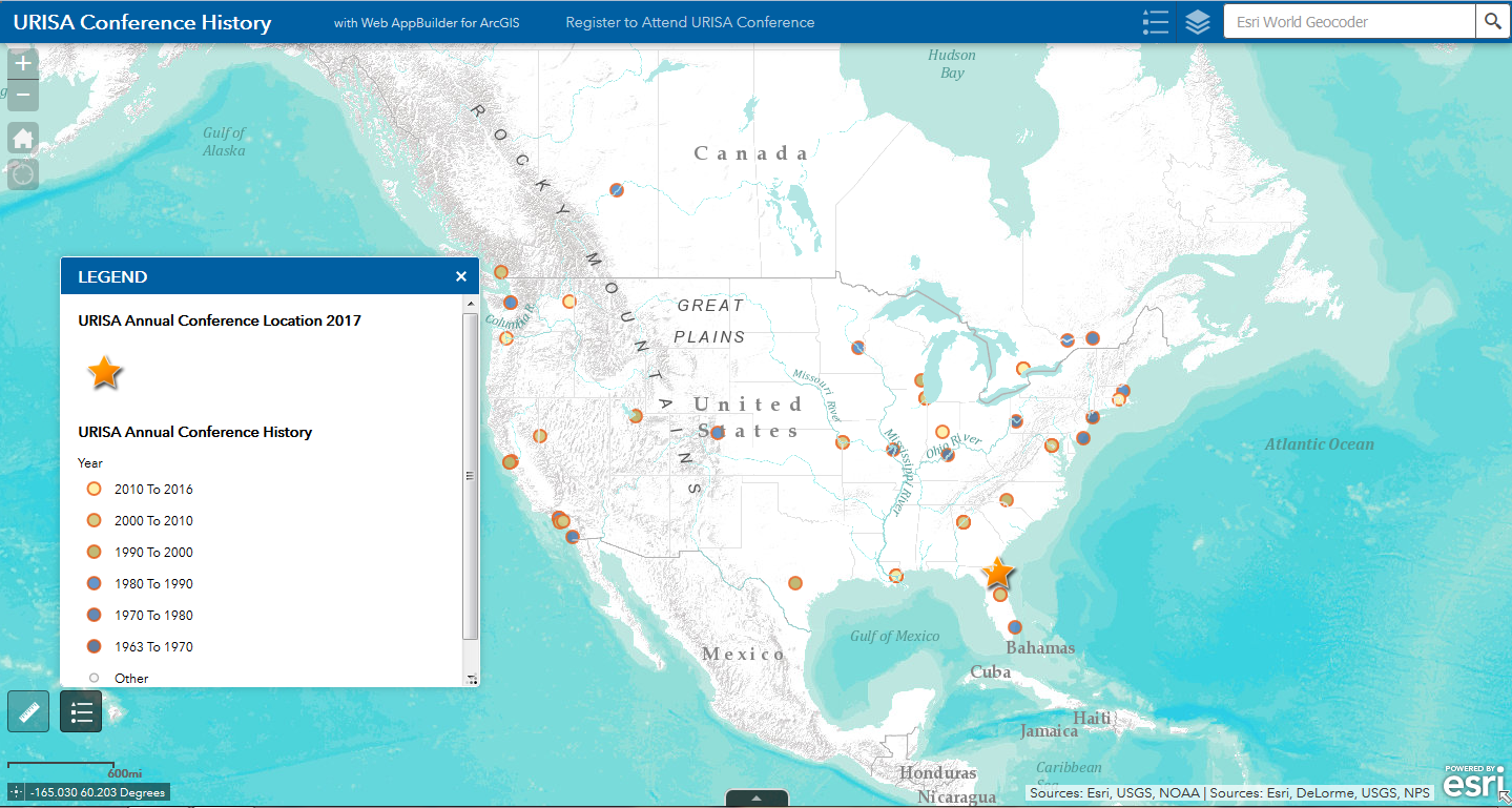
Reba Franklin, Eglin AFB
URISA conference locations & president information - including this year's conference in Jacksonville, Fl. Color coded by decade. Includes a link to registration for this year's conference.
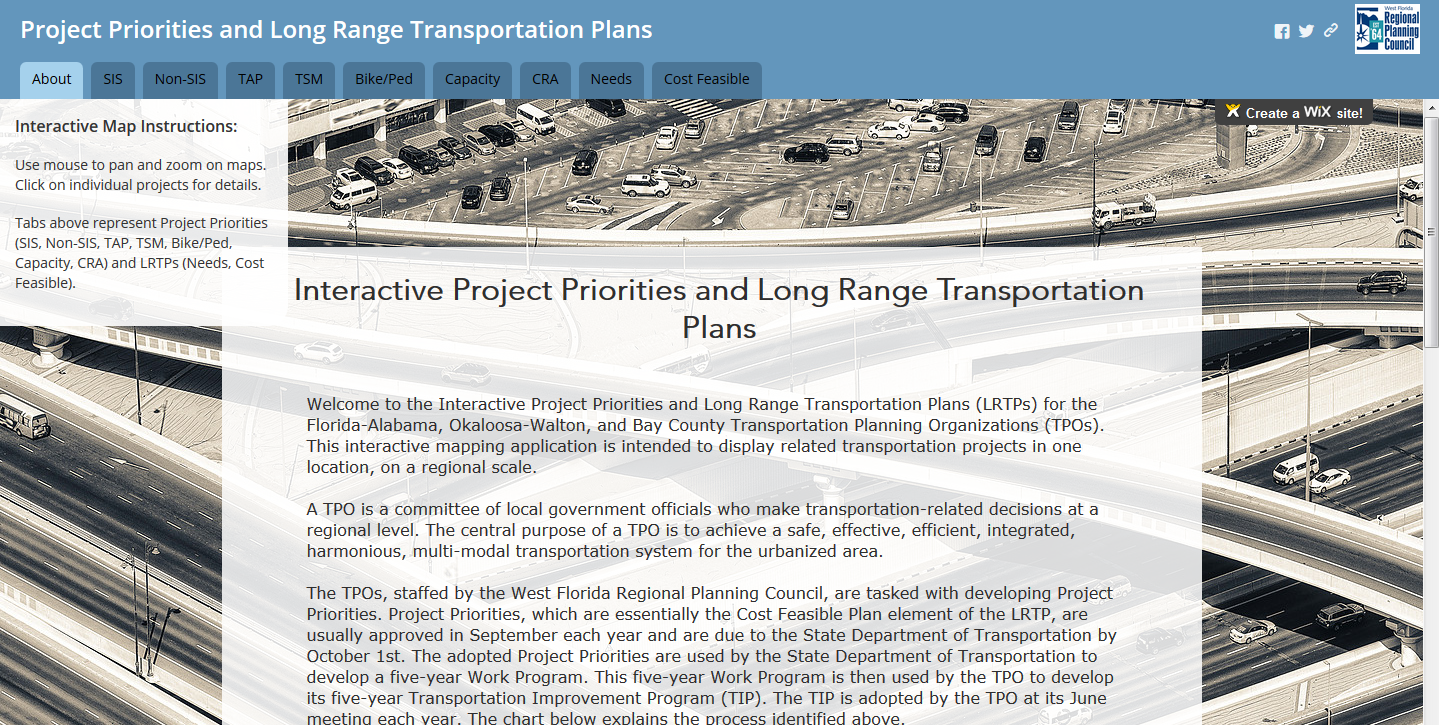
Jessica Paul, WFRPC
This mapping application includes transportation projects from three adjacent Transportation Planning Organizations (TPOs) in the West Florida Region (the Florida-Alabama TPO, Okaloosa-Walton TPO, and Bay County TPO). It was derived from a need for regional collaboration and unification of the three TPOs’ planned transportation projects into one location. Previously, if an organization or individual wanted to view all of the projects included in this mapping application, they would need to reference twenty-three individual maps in nine different plans. This application consolidates those twenty-three static maps into nine interactive maps.
Student Submissions
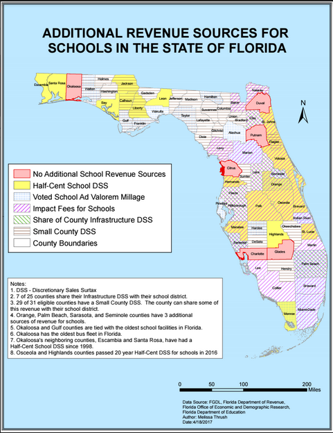
Melissa Thrush, UWF Student - Winner
This map was created to show registered voters in Okaloosa County additional sources of school district funding throughout Florida by county.
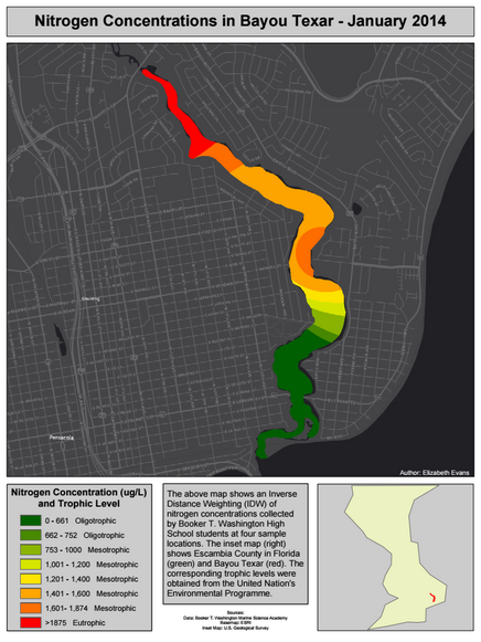
Elizabeth Evans, UWF Student
These maps were developed for water quality data of Bayou Texar collected by Booker T. Washington High School's Marine Science Academy (MSA). The major goal was to create a way for both students and the public to visualize various water quality parameters collected by the high school students. The minor goal was to introduce and educate students about GIS and the process of creating a map. The pdf map shows an example of the product produced using my developed procedure that will be placed on the high school's website and available for download by the public. Due to complications with raster files and ArcGIS Online, an interactive webpage was programmed using Leaflet. The webpage will allow visitors to more easily examine changes in Bayou Texar's water quality. The interface allows visitors to change the basemap and data being viewed. A few sample layers using Nitrogen data have been added to my student site and can be viewed at the provided URL.
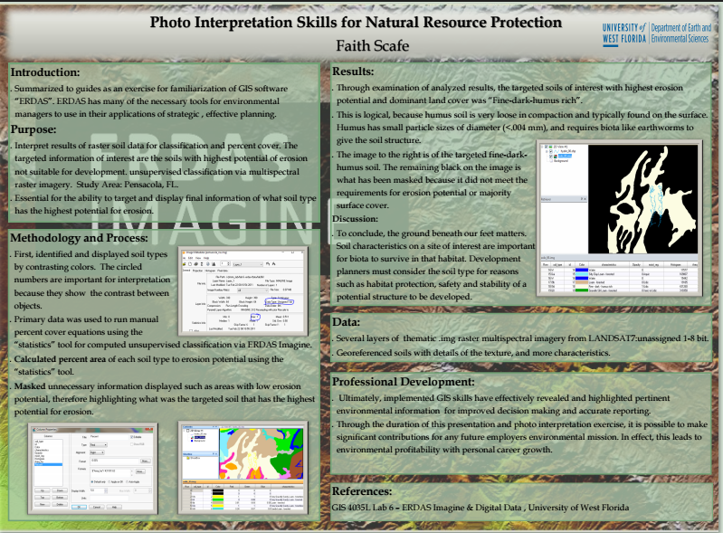
Faith Scafe, UWF Student
This poster was created for future GIS employers and students to see the value and skills to photo and remote sensing for natural resource management.


