


NWFL GIS User Group Digital Media Competition, APRIL 2015 ARCHIVE
In conjunction with the Northwest Florida GIS User Group spring meeting, the GIS Online program hosted an online competition to showcase local GIS digital projects. Here are the submissions.
Shannon Pugh, Escambia County Board of County Commissioners
April 2015 Winner
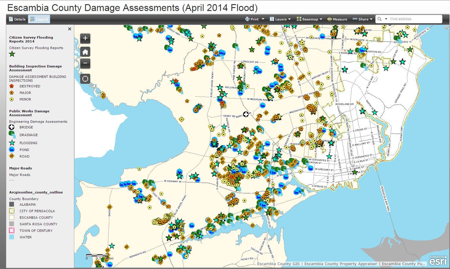
This mapping application (published through ArcGIS Online) depicts the damage assessment that was done after the flooding of April 2014 in Escambia County. Citizens were asked to view the application and then report any flood damage that did not show up on the map. There is a link to a damage report survey form that citizens may fill out under the details tab. We provided map services of the damage assessment to Florida Division of Emergency Management so that they could display the damage assessment as it unfolded on their Sert GATOR web site.
The full online app can be found at: http://escfl.maps.arcgis.com/apps/OnePane/basicviewer/index.html?appid=a9c75e763c3c4e498262e927d1520c0a
Molly Rodriguez, ManTech International, Pensacola, FL
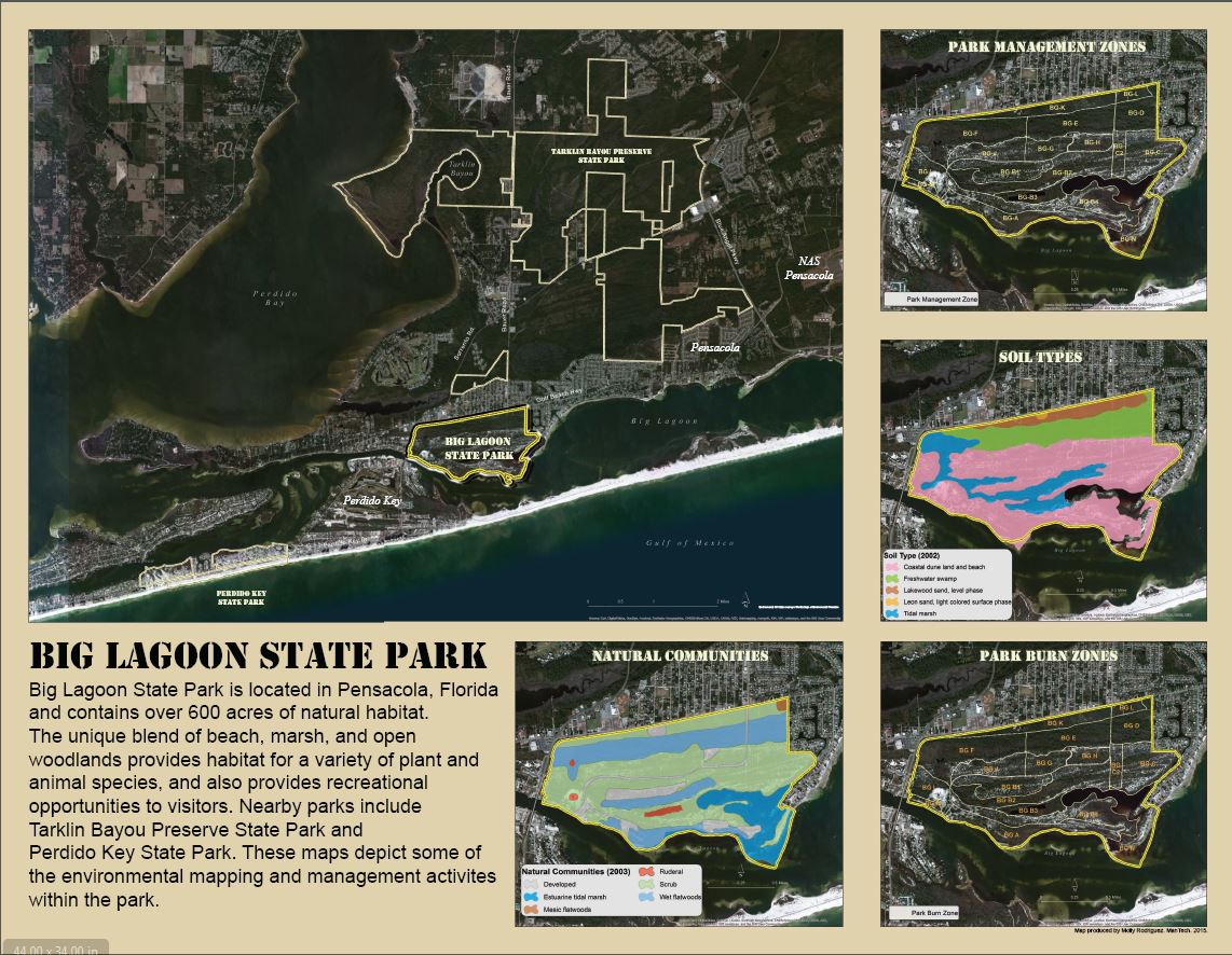
The poster contains several maps depicting various environmental datasets for Big Lagoon State Park. The park does not have in-house GIS capability and I produced this map to give park staff a visual reference for areas where environmental management activities occur. I also mapped soil types and plant communities within the park to help the biological staff with their environmental management. The full electronic map can be found here:
Donna Cole, Bay County BOCC
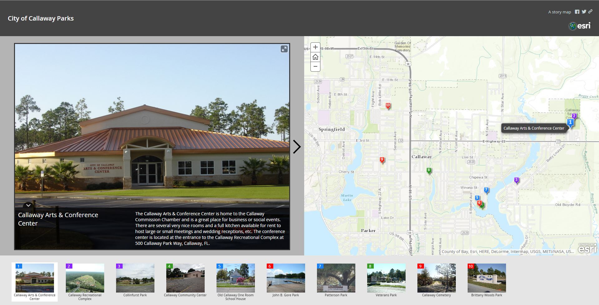
This storybook map is used by the City of Callaway on their Webpage to inform citizens of their public parks and what amenities can be found in each park. This story map can be found at:
http://baycountygis.maps.arcgis.com/apps/MapTour/?appid=3a5708c7ed854ed1bac6626f7290df2c
Reba Franklin, Eglin AFB
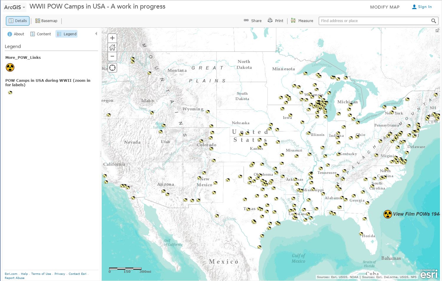
This is a map of POW camps within the United States during WWII. Some camps have links to webpages with more information about the location or the POW camp. The data is based on a list from Wikipedia. Most were researched on line to confirm accuracy. Some additions and modifications were made. Locations based on research and USGS GNIS domestic location data.
The purpose of this map is to illustrate how people at home in America were affected by WWII. Many believe that citizens of Europe were the only people impacted, but that's not the case.
The full webmap can be found at:
http://www.arcgis.com/home/webmap/viewer.html?webmap=4820211f12cd438c90ac9c3583bd8ceb


