


NWFL GIS User Group Digital Media Competition, Fall 2017
In conjunction with the Northwest Florida GIS User Group, the GeoData Center is proud to host this ongoing online competition showcasing local GIS digital projects.
Voting is Closed
Voting is Closed. See below for winners.
Professional Submissions
Florida Resources and Environmental Analysis Center (FREAC), Florida State University
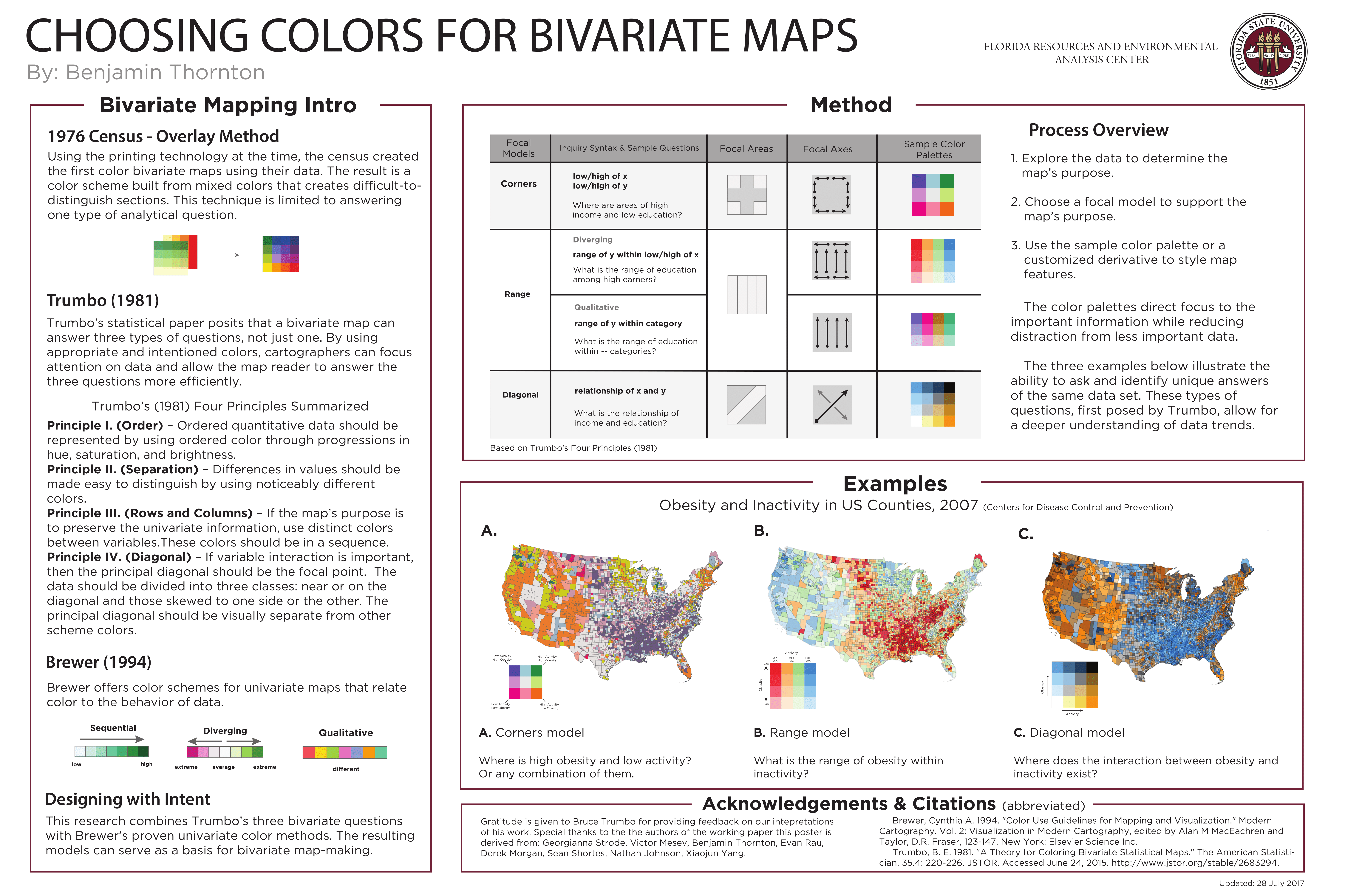
Benjamin Thornton, Georgianna Strode, Victor Mesev, Evan Rau, Derek Morgan, Sean Shortes, Nathan Johnson, Xiaojun Yang
Choosing Colors for Bivariate Maps. Bivariate maps show 2 phenomena simultaneously. Color choices can direct the reader's focus to the important information while reducing distraction from less important data. This research serves as a basis for bivariate map-making with color.
Samuel Nyquist, Jones Edmunds - Winner
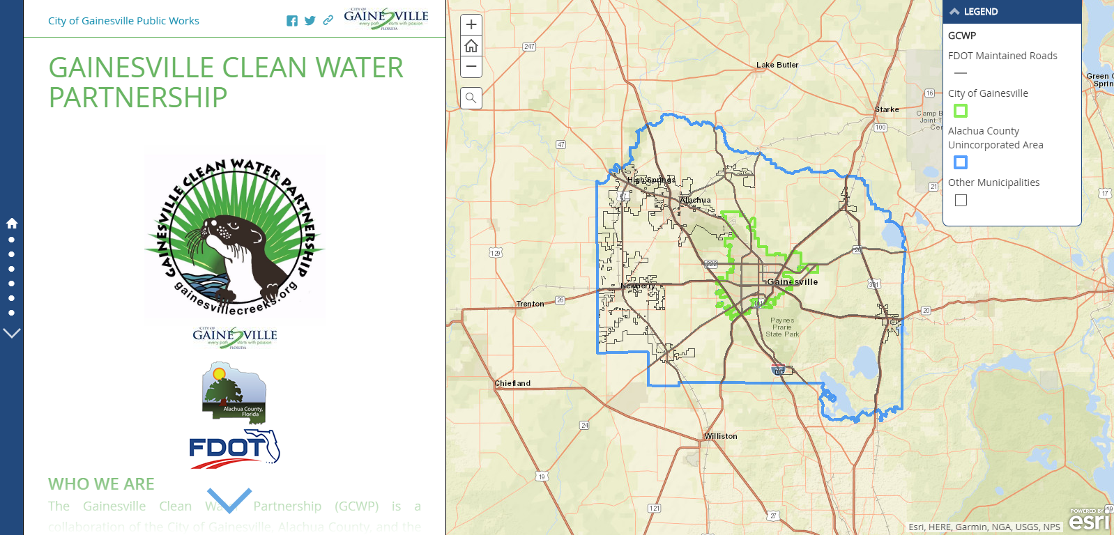
Gainesville Clean Water Partnership Story Map For Public Use
The web map can be found here
Darliene Stanhope, Santa Rosa County BCC Planning Department
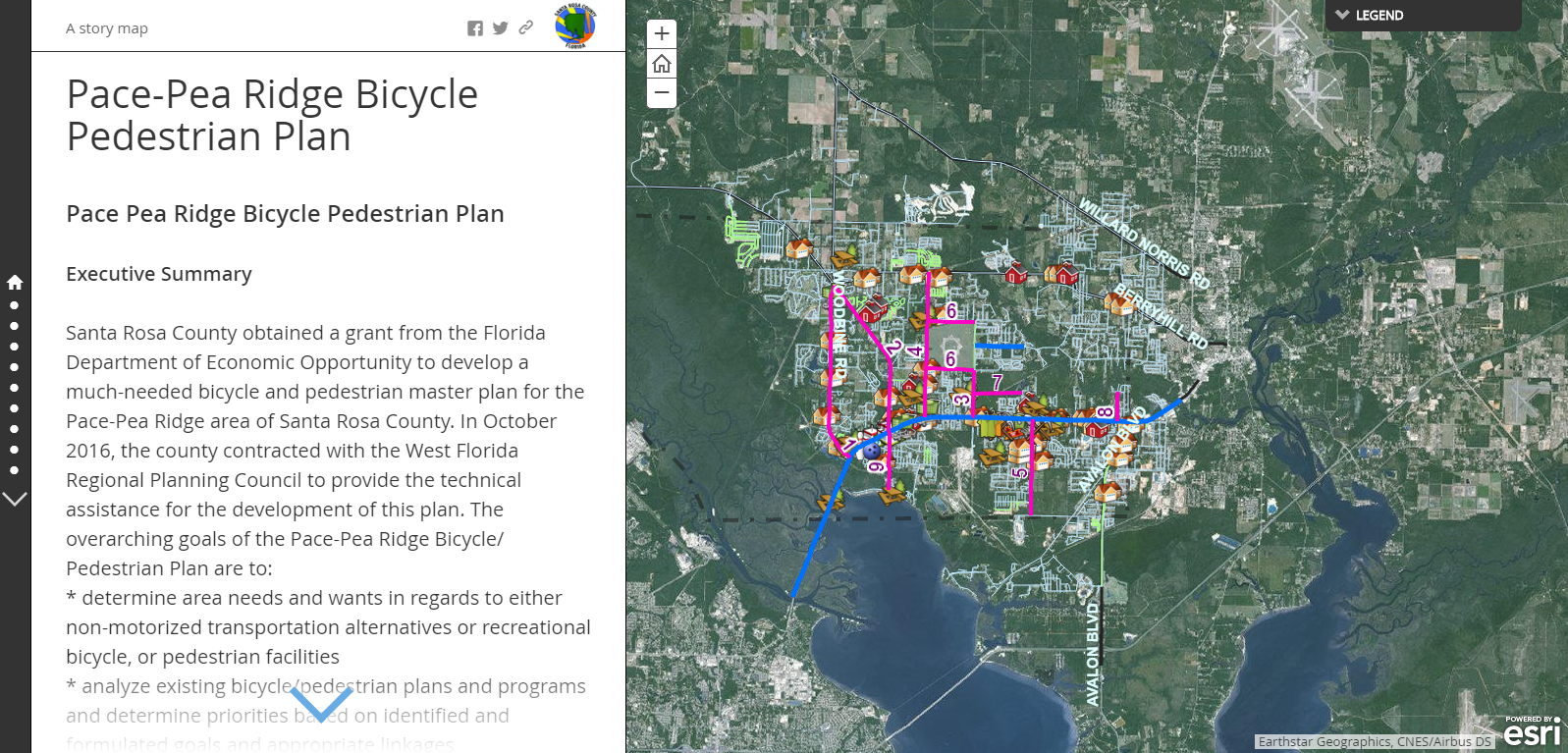
The Pace Pea Ridge Bike Ped Plan Story Map describes the process for coming up with the Pace Pea Ridge Bike Ped Plan and it also maps out the citizen requested bicycle and pedestrian improvements in the Pace Pea Ridge area of Santa Rosa County. It also shows the top 10 citizen ranked projects and will be updated as needed.
The web map can be found here
Student Submissions
Andrew Stevens, UWF Student
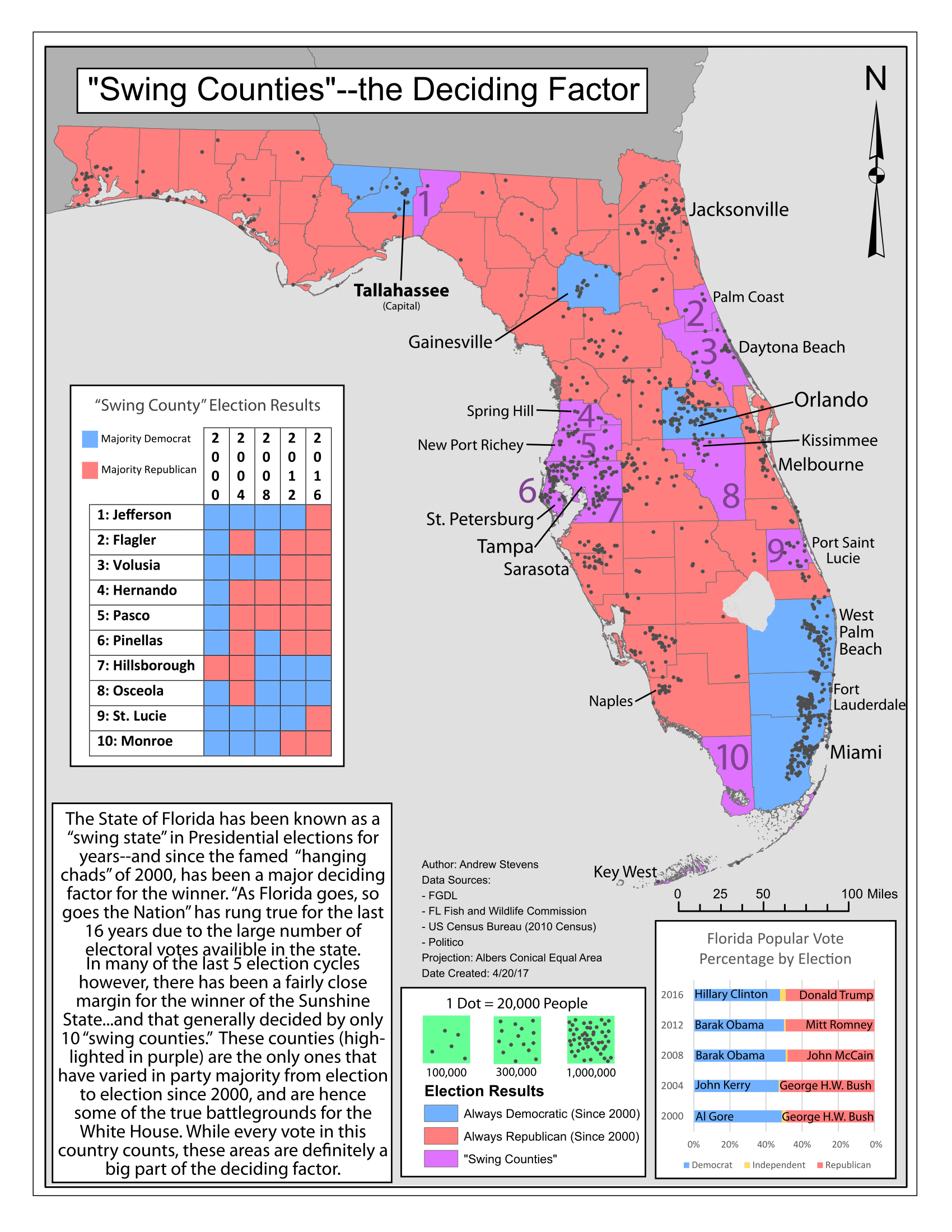
This map was completed for this Spring's "Cartographic Skills" class for UWF's GIS Online Certificate. The map was designed as if it were accompanying a newspaper article using the same subject matter: election returns in Florida by county, and the impact that has had on the winner of presidential elections.
The PDF of this map can be found here.
Daniela Sabillon, UWF Student - Winner
This map illustrates the recent path of Hurricane Nate from October 4 – 8, 2017, before making landfall as a Category 1 hurricane in Louisiana and Mississippi, USA. The purpose of this map is two-fold: 1. To demonstrate the effects that open-data has in providing GIS users the opportunity to create effective, informative, cartographic products of major, recent events; and 2. To showcase the versatility of GIS applications in real-world scenarios. Sharing data is essential in keeping our GIS community thriving. In fact, sharing data fosters academic and workplace innovation. And when this happens, applications are endless. Although Hurricane Nate hit close to home (to most of us Floridians), this map is intended for anyone and everyone.
The PDF of this map can be found here.


