


NWFL GIS User Group Digital Media Competition, Fall 2015
In conjunction with the Northwest Florida GIS User Group spring meeting, the GIS Online program is hosting an online competition to showcase local GIS digital projects. Review and vote for your favorite submission. Winners will be announced at the User Group meeting on Wednesday, October 14, 2015.
Voting has closed.
Michael Broker - NE3RD LLC
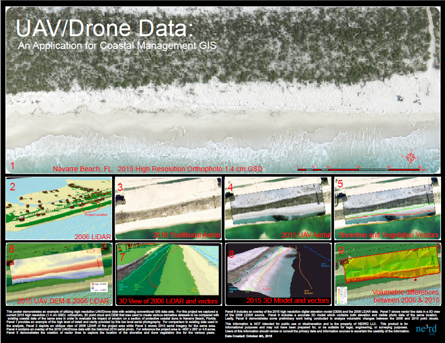
This poster map demonstrates UAV/Drone data that was captured to evaluate the current state of erosion at Navarre Beach, Florida in 2015. Note: The hosted pdf appears correctly in Google Chrome browser but not so much in Firefox. Please note that the file is an E Size document which allows a fair amount of zooming in, (file size: 22 MB).
The hosted PDF is no longer available.
Jason Domico - Bay County GIS
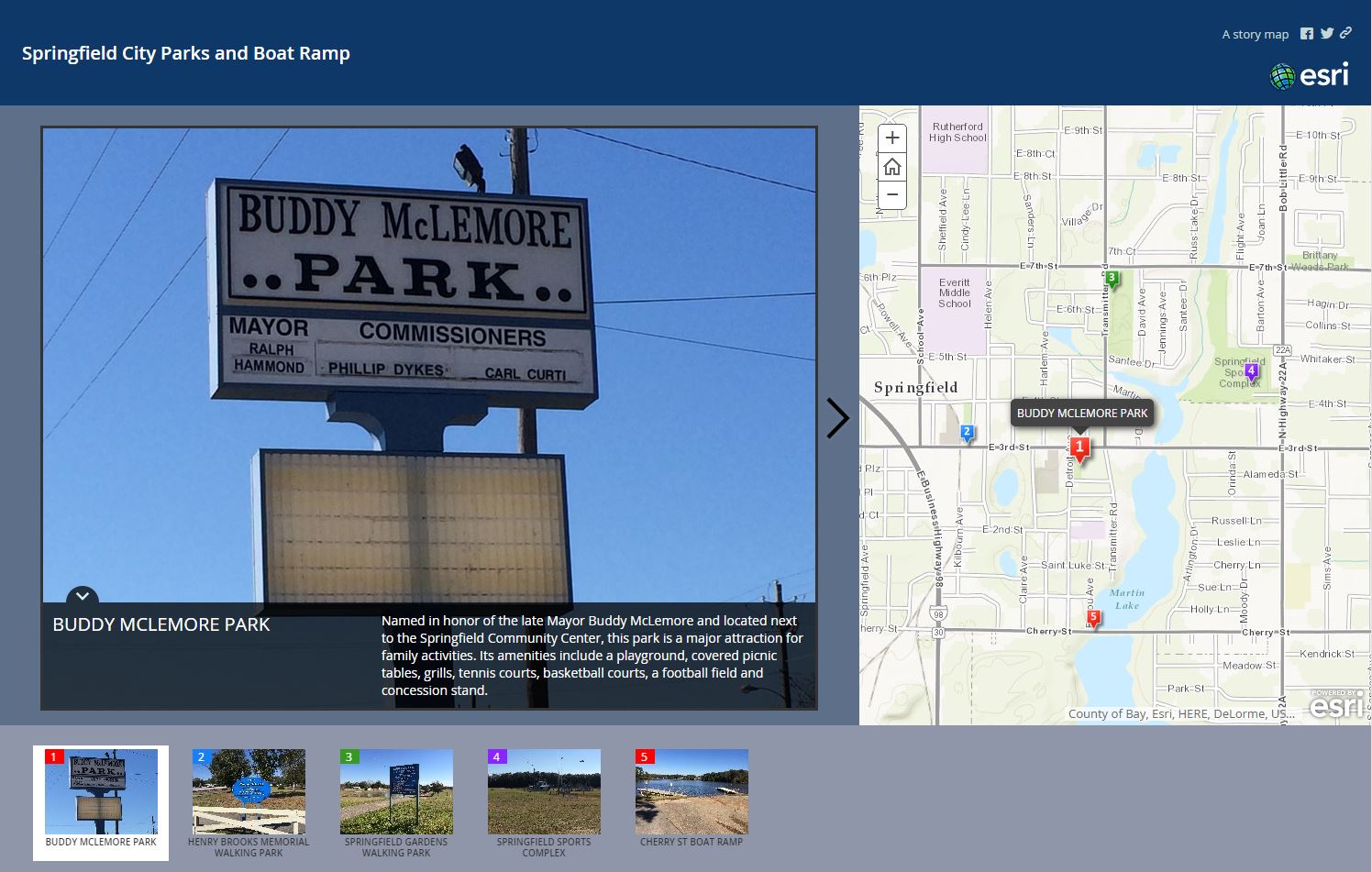
This is a story map of all the city parks and boat ramps in Springfield, FL. It provides citizens with the location of each park and boat ramp as well as a description of the amenities that are available at these locations.
The full online app can be found at: http://baycountygis.maps.arcgis.com/apps/MapTour/?appid=f64abd90158648b0b31b1274b6b09935
Florida Resources and Environmental Analysis Center (FREAC), FSU
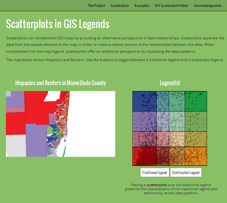
Team members include: Georgianna Strode, Thomas Tricarico, Benjamin Thornton, Nathan Johnson, William Strode, Evan Rau, Xiangmin Xu
Spatial representation of data is a main focus of GIS. Visual analytics offers a complementary perspective by separating the data from its spatial element in order to show relationships between variables in a more direct format. Scatterplots are useful tools for accomplishing this goal. This project introduces scatterplots as a complement to GIS. The first section discusses their capabilities with a demonstration of their use in a GIS legend. The second section is an interactive data visualization – make your own scatterplots! Explore 2010 census block group data in your county with this easy-to-use web tool.
Web Map can be found at: http://freac.fsu.edu/scatterplots/
Alicia Lindbom - UWF Online GIS Graduate Certificate Student
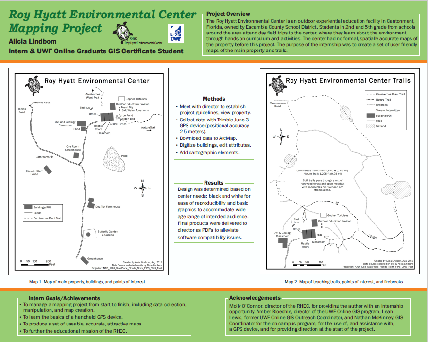
This poster highlights a mapping project I completed through an internship position with the Roy Hyatt Environmental Center. The project consisted of creating a map or maps of the main property and trails at the center, with the intention of providing the maps to visiting students, parents, and guests. The maps may also be used as teaching tools with the students in basic orienteering class. At the start of the project no spatially accurate maps had ever been made for the center. After data was collected in the field, it was downloaded and manipulated in ArcMap to create two maps. A black and white color scheme was chosen for ease of reproducibility, basic graphics were used to accommodate the wide range of ages and skill levels of the intended audience, and final products were delivered as PDFs to the director of the center.
Open the PDF and zoom in to see the maps in more detail. Thank you and enjoy!![]() The full image can be found here:
The full image can be found here:
Chris Mathers, GISP - Bay County BOCC
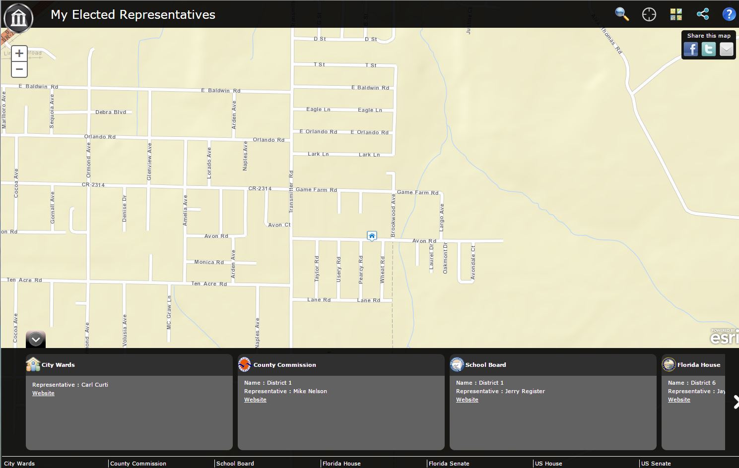
This is a Government Representatives Lookup map, click anywhere in Bay County and get from city council all the way up to US congressional representatives.
The full webmap can be found at:
http://gis.baycountyfl.gov/replookup/
Marvon M. Newby, Jr. - GeoIntegration Office, Eglin AFB, FL
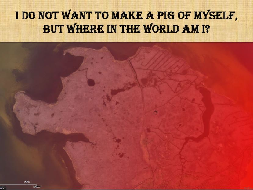
This poster was created with the purpose of getting kids interested in GIS. Based on the concept of "Where is Carmen?" this poster presents a location in the world that resembles a pig. The intention is to get kids to guess what location this is. The image can be found here:
Malcolm Mark Swan - Eglin AFB, FL
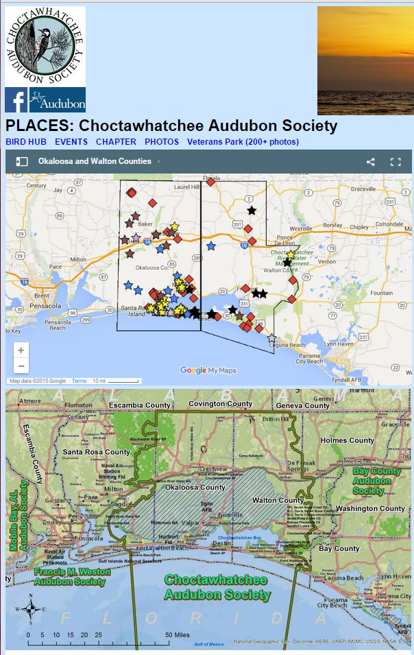
The local chapter of the National Audubon Society is the Choctawhatchee Audubon Society. This 500-member group represents Okaloosa and Walton Counties of Florida. The Places page draws upon Google Maps to present local places for birding and related outdoor activities. Javascript must be turned on in the user's browser settings.
This resource can be found at:
http://www.choctawhatcheeaudubon.org/Places.html
Mary Ann Vance - Santa Rosa County Development Services/Planning & Zoning
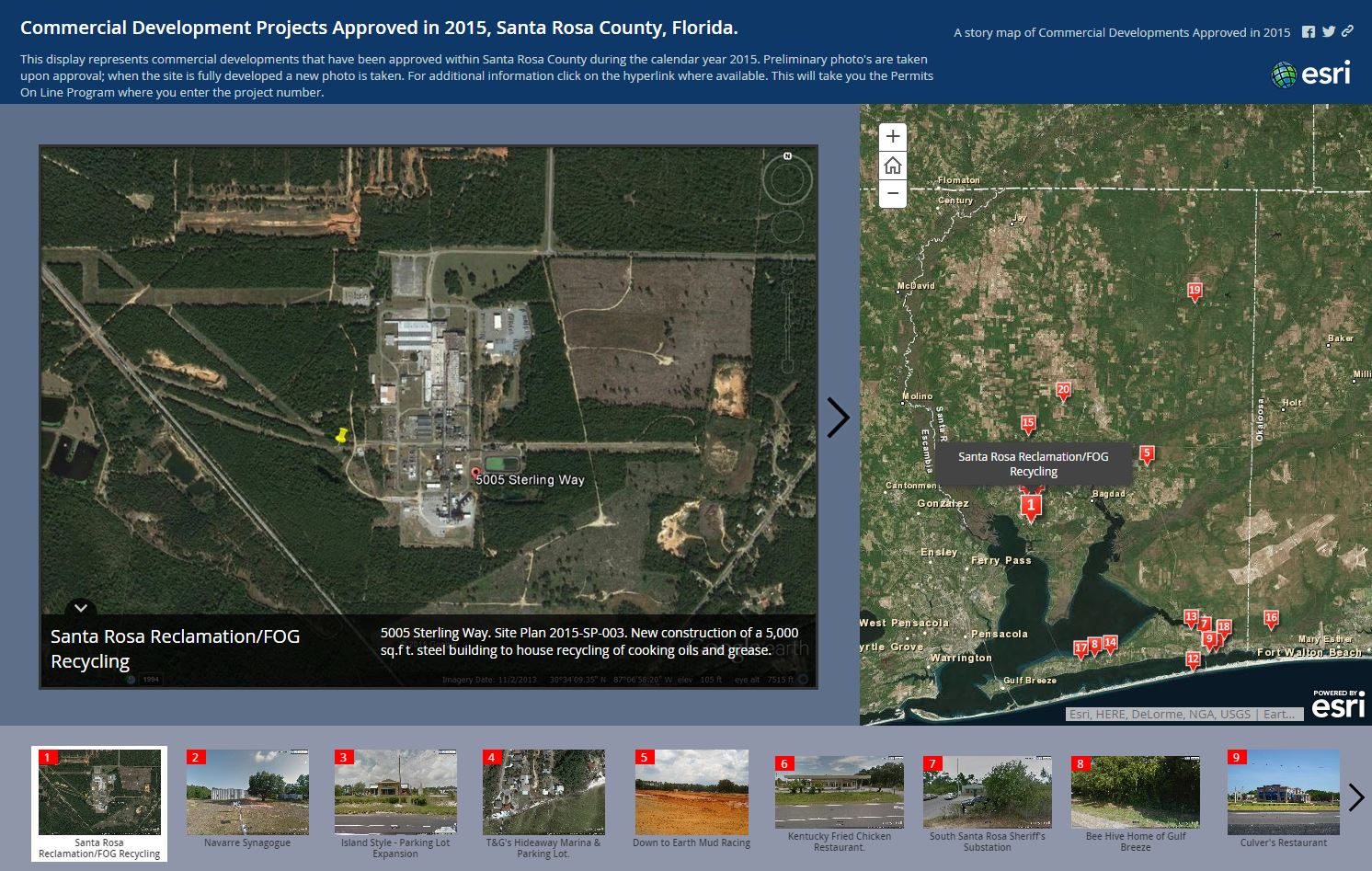
This story map provides both citizens and staff with an overview of what development projects have been approved and are underway within the County for the current calendar year. Each development slide includes a brief description of the project along with a google image of the general location. Site Plan information is provided so that any questions can be readily found when department staff is contacted. Once the project goes into the building development process, that project number is included and hyperlinked to the on-line permitting database so that all stages of the development process can be reviewed.
Advantages of this story map include easy access to information about a project for citizens and employees both in this department as well as other departments within the county. During a recent flood plan meeting a local citizen was expressing concern about a project and the Public Works Department Director immediately used his cell phone to access the story map and familiarize himself with the project.
This story map can be found at:
Michelle Wilson, MHR, GISP - Walton County BOCC, GIS Department
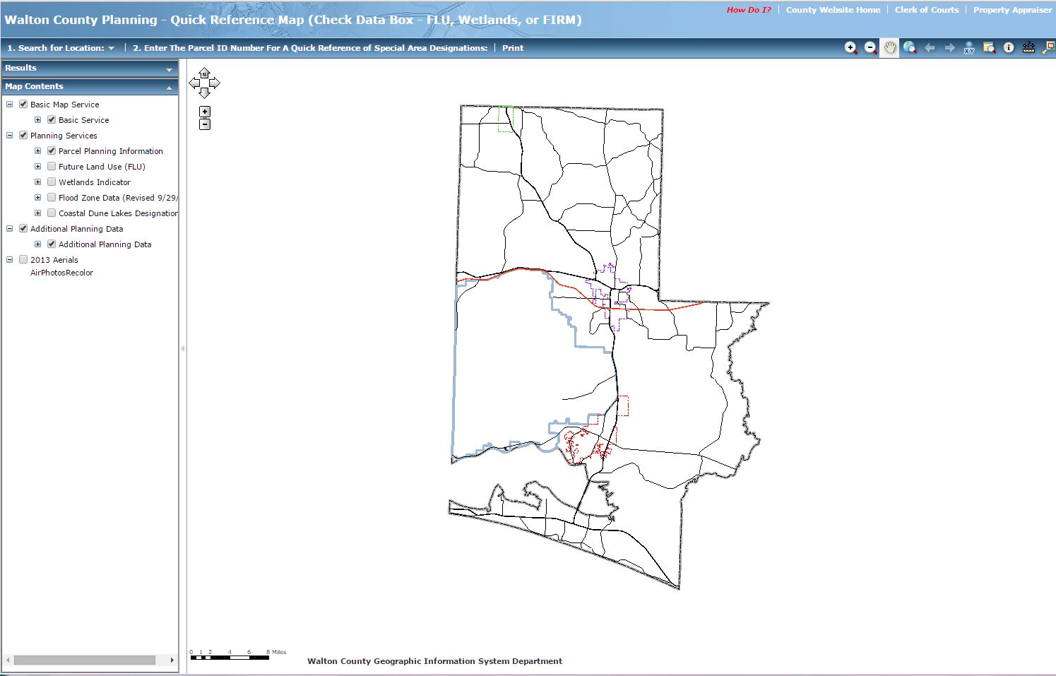
The Walton County Planning and Development Services Department receives an astronomical amount of calls on a daily basis from the public wanting to know if specific parcels are designated a certain zoning, what the designated zoning means, and if the parcel is in special designation area, such as flood zone or wildlife. The Public Planning Web Map is designed to alleviate some of these calls by empowering the public. This web map is no longer available.
Michelle Wilson, MHR, GISP - Walton County BOCC, GIS Department
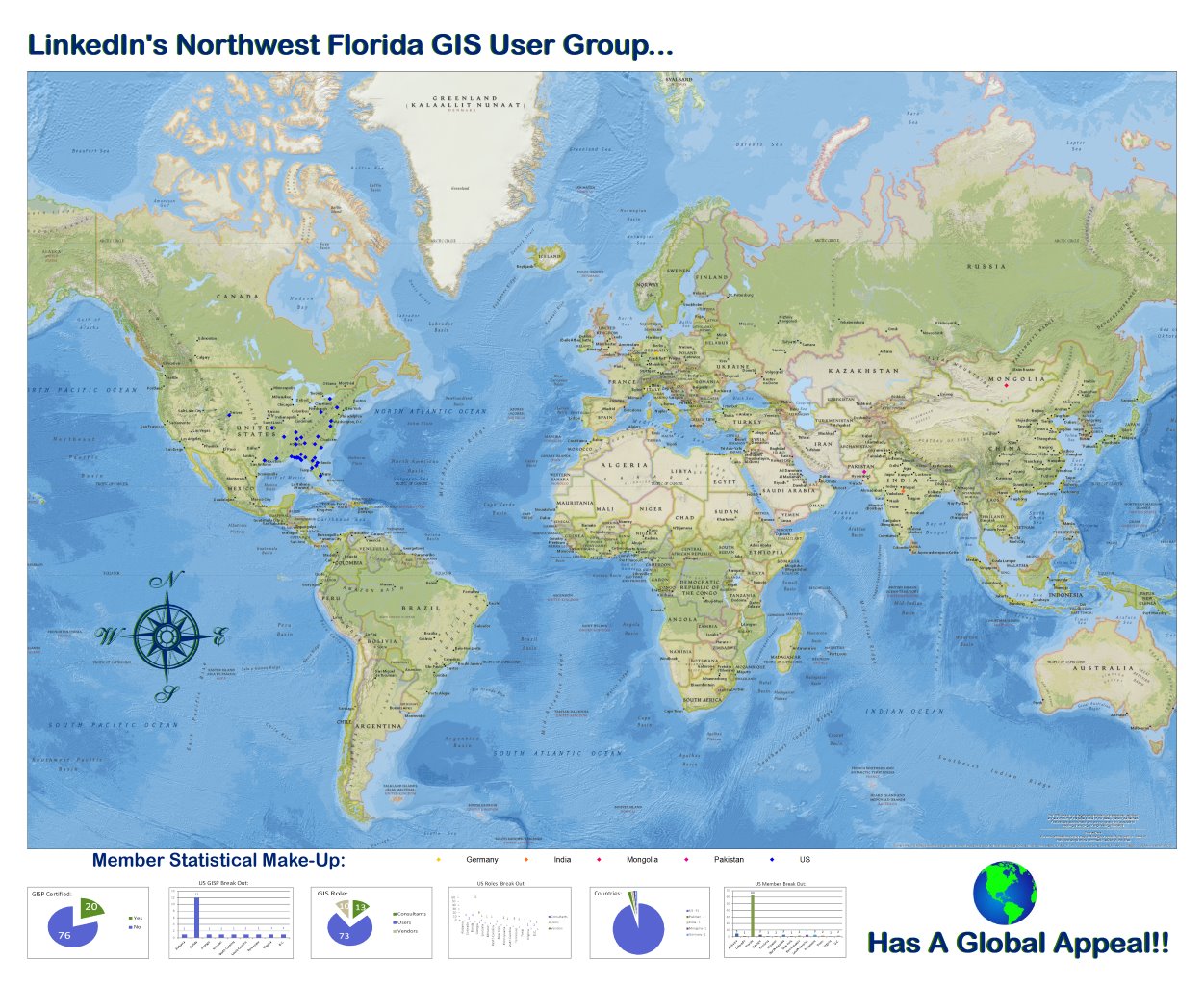
This map is used to display how far the Northwest Florida GIS User Group extends. It also demonstrates education & employment categories demographically broke down worldwide.
This map image can be found at:


